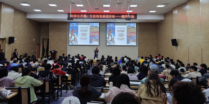
In order to further deepen students' professional cognition, improve their professional self-cultivation, enhance their professional self-confidence, make clear the professional prospect and development direction, and establish the correct career planning as soon as possible, the School of Earth Sciences and Engineering, Hohai University invited Hu Wei, vice president of Shanghai Huace Navigation Technology Ltd, on November 8, 2020, to carry out the we have reached the top of Mount Everest special report.
This report is based on the background of the Chinese survey team climbing Mount Everest on May 27, 2020, focusing on the following four parts: why is it necessary to carry out the third elevation survey of Mount Everest? What is the difference between the third and the previous two? What are the difficulties in measuring Mount Everest? Why can domestic Beidou Positioning Equipment reach the summit of Mount Everest?
Vice President Hu Wei deeply introduced the significance of climbing Mount Everest to the students, as well as the difficulties and challenges encountered in the process. Climbing Mount Everest is not only a process for human beings to understand nature and pursue truth, but also a process of innovation theory and technology improvement in surveying and mapping industry. To the country, it is also a process of development and progress, catching up and surpassing, which is of epoch-making significance. In addition, Vice President Hu Wei also shared some stories about the surveying and mapping work, he repeatedly communicated and interacted with the teachers and students present, and warned the students to bravely climb Mount Everest in their hearts and live up to their good youth. In the exchange and interaction, the teachers and students at the meeting deeply realized the development and strength of the country, the significance and responsibility of Surveying and mapping work, and strengthened the belief and goal of hard study and growth.
The content of this report is in line with the hot spots and close to the reality, which makes the professional students deeply realize the importance of Surveying and mapping discipline and the great contribution of surveying the motherland's mountains and rivers. It plays an important role in cultivating students' professional interest, enhancing their professional confidence and their professional sense of mission and self-confidence.
